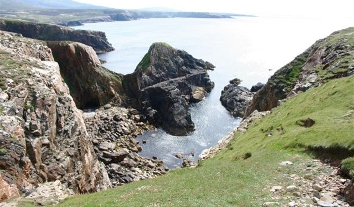
Stac Dhomhnuill Chaim

Mangersta, Isle Of Lewis, Outer Hebrides, HS2 9EY

Type:Monuments & Ruins

Add Stac Dhomhnuill Chaim to your Itinerary

Product Image

Book Tickets Online

About

Oral tradition tells that it was once a hideout and fortress for the well-known outlaw and hero, Dhomhnuill Chaim MaCaulay who lived in the late 16th/early 17th centuries. It is a dramatically shaped stack, nearly 50m high, but only 20m in diameter on top, and is joined to the mainland via a 60m long knife-edge or spine of rock, which was originally passable as a small path - Donald's sister "Big Anne" is said to have carried large vessels of milk across this path for Donald when he was in residence. A similar refuge is said to have been used by Neil MacLeod, a friend and ally of Donalds, over on the island of Berisay.

In 1890 Captain F. W. L. Thomas:Stac described it as "quite inaccessible, except on the land side, where a narrow path leads up the steep brae. A wall, from 4 to 5 feet thick, defends it on the land side, in which, at the south end, there is a gap or gateway, 2 feet wide. The gate would be extremely dangerous to force, as the cliff is close in front of it. There are the ruins of a cottage, 18.5 by 10 feet interiorly, and the walls 4.5 feet thick, on the terre pleine of the rock, as also a sheep-pen attached to the wall."

Today the narrow path across the isthmus has all but gone, but the buildings can be seen clearly from the adjacent cliffs.

In 2006, a local descendant of Dhomhnuill Chaim visited the site in conjunction with the STAC (Severe Terrain Archaeological Campaign), and found a large piece of pottery, which has since been identified as early pre-historic, possibly Neolithic.

Map & Directions

TripAdvisor

What's Nearby

  1. Low growing white flower with 5 petals found in rocky crevices and shingle on coast

    0.22 miles away
  2. One of the largest fish seen in the waters around the Outer Hebrides.

    0.29 miles away
  3. You will find Mangurstadh Gallery, a  family run business, on a working croft in Uig,…

    0.58 miles away
  1. Traigh Mhangurstadh (Mangersta) is a beautiful beach in the parish of Uig in south west…

    1.36 miles away
  2. Ard Feinis is a rocky promontory just south of Mangurstadh in the south west of Lewis.

    1.47 miles away

  3. Photograph © David Wilson


    The glorious bay at Uig, south west Lewis, has many of…

    2.22 miles away
  4. Short, low growing with spike of bright yellow flowers

    2.25 miles away
  5. Camas Uige or Uig Bay is in a national scenic area in the south west of Lewis.

    2.79 miles away
  6. In the remote region of uig on the Isle of Lewis, you will find Uig Heritage Centre. …

    3.79 miles away
  7. An open studio situated in an old byre overlooking the Atlantic in the crofting village…

    4.93 miles away
  8. Cliff Studio, located by Cliff Beach, Valtos, Uig, shows coastal landscape and abstract…

    5.72 miles away
  9. Camas na Clibhe (Cliff beach) is a quartz sand beach situated on the Valtos peninsular in…

    5.91 miles away
  10. Traigh na Beirghe (Reef Beach) is a very long, sweeping, white sand beach in Uig

    6.68 miles away
  11. Public Art structure by artists Marian Leven and Will Maclean that reflects local,…

    6.72 miles away
  12. A low growing plant with small white 2 lobed flowers. Found on improved agricultural land…

    6.89 miles away
  13. Tall, slim stems with pale blue flowers

    7.02 miles away
Previous Next

My Planner

You can build your own holiday itinerary here! Just browse our site and click this button to add to your itinerary when you see something you like. If your planner is not finished, simply click save and you can come back to it later on! You also have the option to send your itinerary to our tailor made holiday partner.

Places to Eat

Our Islands