To provide you with the best experience, cookies are used on this site.  Learn more

Allow cookies

Udal Walk

Add Udal Walk to your Itinerary

Traigh Iar, North Uist

About

Image: https://www.instagram.com/allankeyte/

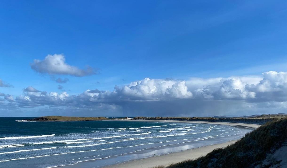
The Udal Peninsula is one of the richest human and natural environments of the Outer Hebrides. It is an exciting and beautiful time capsule preserving centuries of human and natural impacts. At its heart is the 'machair' - a Gaelic word meaning ‘fertile plain’. For thousands of years families have farmed and continue to farm this rich landscape.

Explore this peninsula where sea and sand meet under a magic, open sky. Follow shorelines and paths through flower-studded machar to an old cemetery. Climb a hill for fabulous views, and return via coves and ancient archaeological sites that rank as some of the most important in the Outer Hebrides. 

A walking tour App exploring the Udal and its heritage and environment, as told by members of the community, is available to download free to your tablet or phone HERE, via the izi.travel storytelling platform. You must first download the izi.travel App to then download the audio tour.

You can download a leaflet here

Map & Directions

Route Waypoints
  1. Park at the picnic area along the minor road that leaves the A865 at Grenitote. Start the walk here.
  2. Follow the track, crossing the burn on stepping-stones (or go left a little way to find the bridge). Continue round the vast beach-bowl expanse of Traigh Ear. Depending on the tide, you could venture out onto the sands
  3. Once through the dunes, the beach becomes rockier after a while: it’s easier to take the track through the machair fields.
  4. The track leads to the cemetery of the Macleans of Boreray, the island directly north-west of here.
  5. It’s time to climb the hill: just head up from the cemetery. Even though it is only 40 metres high, it feels like a sharp tug up to the trig point
  6. Drag yourself away from the view and descend to the south. Go down, then up and down, and find a path through the dunes.
  7. These are the archaeological sites of the Udal, once a major medieval settlement.

Route Guides

Route Time -

3h

Distance -

7 miles

Grade -

Moderate

Route Type -

Walk

Along This Route

  1. The Udal is thought to have been occupied from the Neolithic Age right up to the early…

  2. Sollas beach is a stunning white sandy beach and eaily accessible from the village of…

What's Nearby

  1. Download the Uist Unearthed app and discover two sites in one at Dùn an Sticir! Watch the…

    4.44 miles away
  2. Download the Uist Unearthed app and discover more about this mastery of Iron Age drystone…

    4.84 miles away
  1. 14.55 miles away
  2. This Benbecula and South Uist self guided audio tour will take you to Culla Bay in…

    15.71 miles away
  3. 15.92 miles away
  4. 19.25 miles away
  5. 27.11 miles away
  6. Located just outside the gate to Eilean Glas Lighthouse, Scalpay Bothy offers shelter and…

    28.01 miles away
  7. The breath-taking views over Loch Seaforth and the chance to see native trees in an…

    29.68 miles away
  8. Download the Uist Unearthed app and reveal an impressive Viking longhouse, which…

    30.43 miles away
  9. Download the Uist Unearthed app and step back 2000 years ago, to explore Cill Donnain…

    31.43 miles away
  10. Download the Uist Unearthed app and step back 3500 years ago to explore conjoined Bronze…

    35.43 miles away
  11. 36.62 miles away
  12. Cliff Studio, located by Cliff Beach, Valtos, Uig, shows coastal landscape and abstract…

    39.23 miles away
Previous Next

My Planner

You can build your own holiday itinerary here! Just browse our site and click this button to add to your itinerary when you see something you like. If your planner is not finished, simply click save and you can come back to it later on! You also have the option to send your itinerary to our tailor made holiday partner.

Places to Eat

Our Islands