Wayfinder
Udal
Grade
ModerateType
WalkDescription
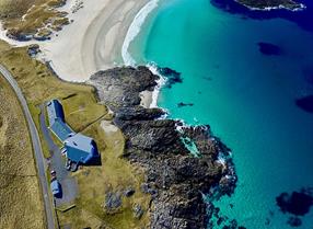
Explore a strangely-shaped peninsula where sea and sand meet under a magic, open sky. Follow shorelines and paths through flower-studded f ields to an old cemetery for another island. Climb a hill for fabulous views, and return via untrodden coves and ancient archaeological sites that rank as some of the most important in the Outer Hebrides. Along the way, you’ll barely see a soul. You will feel as though you are the only folk in the world, though history will surround you, and who knows what birds you will chance upon.
Walk Waypoints
- 1 Park at the picnic area along the minor road that leaves the A865 at Grenitote. Start the walk here.
- 2 Follow the track, crossing the burn on stepping-stones (or go left a little way to find the bridge). Continue round the vast beach-bowl expanse of Traigh Ear. Depending on the tide, you could venture out onto the sands
- 3 Once through the dunes, the beach becomes rockier after a while: it’s easier to take the track through the machair fields.
- 4 The track leads to the cemetery of the Macleans of Boreray, the island directly north-west of here.
- 5 It’s time to climb the hill: just head up from the cemetery. Even though it is only 40 metres high, it feels like a sharp tug up to the trig point
- 6 Drag yourself away from the view and descend to the south. Go down, then up and down, and find a path through the dunes.
- 7 These are the archaeological sites of the Udal, once a major medieval settlement.


