


About
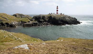
Along this walk you will discover Ceann a’ Bhaigh, Lag na Laire, Beinn Scorabhaigh with breathtaking views North and South across the Outer Hebrides and towards Skye and the mainland. The highlight of the walk is undoubtedly the magnificent red and white Eilean Glas Lighthouse to the south east of the island.
For more information and to download a leaflet click here.
Map & Directions
Route Waypoints
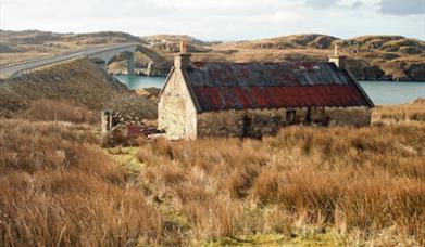
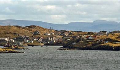
- Once over the bridge, turn immediately left to reach the processing factory at Port na Geiltan (NG223971) and then right back towards the main township. Park considerately in one of the gravelled lay-bys and walk south to the corner and a group of three houses. Although the route is promoted as the Scalpay Heritage Trail and is well marked throughout its length with yellow topped posts, there is nothing to indicate the start. But it is here and if you look to the right below the low cliff you can actually see it. So how do you get there? Go through the gate that leads to the furthermost house, turn right immediately before it and pass through another gate and you’re out on the moor. This good gravelled track takes you to Loch an Duin (NG227965) where there are the remains of a dun once reached by a causeway that is now submerged since the outflow to the loch was damned to raise the water level. Go left, crossing a stile and a footbridge and you are at the first marker pole. It’s now just a matter of following them down the length of the island. However the route is very wet and you may wish to retreat to the higher ridges in search of drier ground.
- At the end of the loch the route passes through a gate then turns along the south side of Loch Cuilceach (NG233962) before climbing up to the twin cairns at the summit of Beinn Scorabhaig (NG237957). The views north to the empty Pairc area of South East Lewis and the Shiants Isles out at sea are well worth the exertion and the sodden feet.
- From here, you can see Eilean Glas lighthouse below (NG247947) and the route sweeps round a group of unnamed lochs towards it. The lighthouse is surrounded by a fine stone wall which was built to provide shelter for the crops that the keepers grew in order to be self sufficient in this remote spot. Turn right and follow the wall to a gate which leads directly to it. Not only was Eilean Glas lighthouse the first in the Outer Hebrides; it was the first on the whole west coast of Scotland. Building was started in 1787 and completed in 1789 by Thomas Smith, father-in law of Robert Stevenson, the first of the famous Stevenson dynasty of lighthouse builders, who were responsible for the later addition of the tower and the keepers’ accommodation. In late spring and during the summer months, puffins can be seen along the top of the cliffs. However birdlife didn’t always have it so good at Eilean Glas; the last Great Auk recorded in Scotland was captured here in 1821.
- Return through the gate, turn left along the wall and follow the marker posts southwest down to Lag na Laire (NG233943).
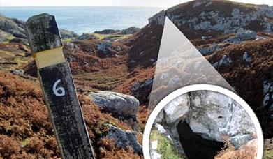
- Continue following the marker posts northwards to reach the road at Ceann a Bhaigh (NG232948), Near marker post 6, you can explore the cave on Lag na Laire where Bonnie Prince Charlie is supposed to have hidden from the Hanoverian troops after his defeat at Culloden.
- The three kilometre walk back to the start provides continual interest. There are distant views of the hills of North Uist and plenty to keep you occupied nearer to hand with deserted crofts, lazy beds, boats and an embarrassing number of yappy dogs that seem to send the alarm from house to house.
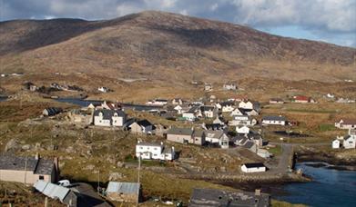
- After a longish stretch alongside An Acairseid a Deas (South Harbour), the road leads to the busy village scattered around An Acairseid a Tuath (West Harbour).
- Turn right at the bridge at Ceann a Bhaigh (NG218967), the second on this route, and you’re back at the start.


