To provide you with the best experience, cookies are used on this site.  Learn more

Allow cookies

Crabhadail Walk

Add Crabhadail Walk to your Itinerary

Product Image

About

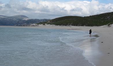
When it’s washed by turquoise waves coming in from the Atlantic, many people would rank the silver beach of Tràigh Huisinis as one of the most enchanting places there is anywhere in the world. The other beaches that can also be visited on this walk would also score fairly highly so if it’s a pleasant day you will undoubtedly want to wander along the shore and search among the rock pools. Because of this natural urge, the walk has been kept deliberately short.

[A longer version of this walk that includes an ascent of Huisinis Mhor is described in detail and illustrated with Ordnance Survey map extracts in 'Walking on Harris and Lewis' by Richard Barrett, published by Cicerone Press 2010. Unless otherwise indicated, all images used here are copyright of the author.]

Download a leaflet of this walk here.

Map & Directions

Route Waypoints
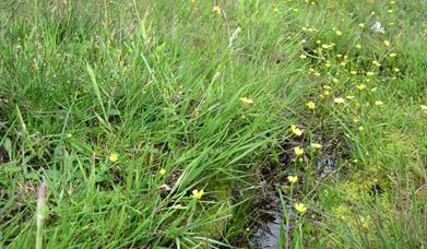
  1. There is ample parking near the toilets, (NA 992121), which must be the most beautifully situated public conveniences in the UK. You would happily leave the door open to enjoy the view! Head north east across the machair, famous for creeping willow and Scottish bluebells (harebells), and then pass through a gate to gain access to the footpath, known locally as the “Stiamair”,
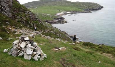
  2. Although the path is sound, it is rugged at times with an occasional steep drop down to the sea, so move carefully and give plenty of reassurance to the less confident in your party.
  3. At a junction in the path, strike out right up a pleasant little valley towards Loch na Cleabhaig (NB 005135).
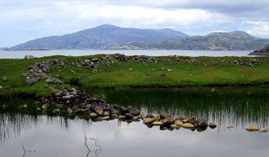
  4. Keep going past the cottage to reach an un-named beach at Tharanais which is backed by the old sheilings and lazy-beds of Crabhadail.
  5. From here, follow the coast north west around the headland of Mellein to the beach opposite Scarp.
  6. Walk along the beach to its western end
  7. Pick up a path that soon rejoins the main route over the cliffs

Route Guides

Route Time -

3h - 4h

Distance -

5 miles

Grade -

Moderate

Route Type -

Walk

Along This Route

  1. Hushinish is a small settlement of only 4 houses overlooking a white sand beach in the…

What's Nearby

  1. 11.19 miles away
  2. The breath-taking views over Loch Seaforth and the chance to see native trees in an…

    11.42 miles away
  1. 15.16 miles away
  2. Cliff Studio, located by Cliff Beach, Valtos, Uig, shows coastal landscape and abstract…

    16.05 miles away
  3. 16.53 miles away
  4. Located just outside the gate to Eilean Glas Lighthouse, Scalpay Bothy offers shelter and…

    18.95 miles away
  5. Download the Uist Unearthed app and discover two sites in one at Dùn an Sticir! Watch the…

    22.04 miles away
  6. Download the Uist Unearthed app and discover more about this mastery of Iron Age drystone…

    24.54 miles away
  7. The Braighe is the stretch of land (isthmus) linking Point and the villages of Branahuie…

    32.6 miles away

  8. 33.01 miles away
  9. This communal burial tomb would have been an important highly visible monument of the…

    35.27 miles away
  10. 37.42 miles away
  11. This Benbecula and South Uist self guided audio tour will take you to Culla Bay in…

    38.75 miles away
  12. This east coast of Lewis self guided audio tour will take you as far north as the village…

    40.91 miles away
Previous Next

My Planner

You can build your own holiday itinerary here! Just browse our site and click this button to add to your itinerary when you see something you like. If your planner is not finished, simply click save and you can come back to it later on! You also have the option to send your itinerary to our tailor made holiday partner.

Places to Eat

Our Islands