


About
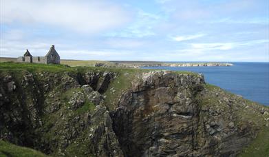
This is a walk packed with magnificent views, history and legend. The “Bridge to Nowhere” (NB 531501) which spans Abhainn Ghearadha is all that remains of Lord Leverhulme’s scheme to push a road through to Port Nis. Dùn Othail, (NB 543515), a natural fortress nearly 200ft high which is separated from the mainland by a steep ravine called Nicolson’s Leap and near the end Filiscleitir (NB558576) is perhaps the highlight of the route.
[This walk is described in detail and illustrated with Ordnance Survey map extracts in 'Walking on Harris and Lewis' by Richard Barrett, published by Cicerone Press 2010. Unless otherwise indicated, all images used here are copyright of the author.]
Map & Directions
Route Waypoints
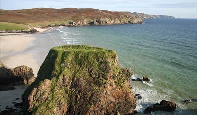
- Walk to the end of the B895 road, cross the cattle grid and follow the unfenced road northwards with views down the expanse of Traigh Mhòr, (Big Beach), towards Tolsta Head and across The Minch to the prominent peak of Suilven and its neighbours on your right. As the road passes below Ben Geiraha, the smaller beach of Traigh Ghearadha, (Garry Beach), comes into view with the remains of Caisteal a’ Mhorair, (NB 53796 ) precariously perched on one the prominent rock stacks that tower 70ft above the sands. It is thought to be the remains of a medieval stronghold or a 'late dun'.
- Continuing north, the marker posts lead inland for 500m or so to the west of Loch Dubh an Toa and onwards to Loch Sgeireach na Creige Brist over the undulating moor. The trail goes inland again to cross Gil an Tairbh ("stream of the bull") and Gill Dibadale which join just before flowing into the sea as Cladach Dhiobadail.
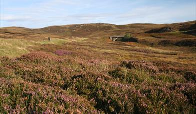
- There are remains of sheilings at both Aird Dhiobadail and at Lower Dibadale (NB554 546). Leave this pleasant little valley and follow the red-capped posts that mark a short diversion to the route shown on the map. After a couple of hundred metres, the routes come back together and from then on it is probably best to stick close to the main path marked by the yellow-capped posts as the ground to the east around the Bacabhat lochs and out towards Rubha an t-Selieir, “Cellar Head”, is so up-and-down that it’s tiring.
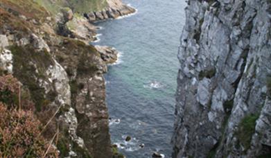
- The ruins at Maoim (NB556 568) are quickly reached and the ground gets easier towards Filiscleitir (NB558576).
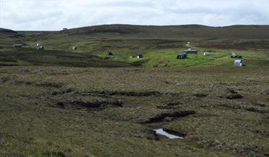
- Following the marker posts soon leads to a gravelled track which was built by people of the townships themselves well before Leverhulme proposed a road from Ness to Tolsta and appears on OS maps from the middle of the 18th century. The summer shielings along the banks of Abhainn Dubh at Cuidhsiadar (NB545562) show that some local people are still coming out to enjoy the moor during the summer months just as their ancestors did - and being resourceful Hebredians they will make best use of whatever is at hand.
- Continue towards the road end at Sgiogarstaigh and onwards to your final destination.


