Wayfinder
Section B - Northbay to Daliburgh
Grade
Easy to ModerateType
WalkDescription
The route is on grassy/sandy paths and tracks and a few miles on quiet tarmac roads and also includes a ferry crossing from Ardmhor to Eriskay.
Walk Waypoints
- 1 Leave the main road here and head up the small track towards the water works.
- 2 Just before the entrance to the water works head left up the hillside.
- 3 At the top of a small rise a line of waymarker posts becomes visible heading off to the right. Follow these across close cropped heather and damp moorland as the route leads you over the eastern flanks of Beinn Eireabhal. There is no path, so just follow the posts, but the walking is easier than it looks...
- 4 As you gain height there are wonderful views of the north of Barra. The distinctive jagged outlines of the islands of Skye and Rum can be seen on the horizon.
- 5 As you come round the shoulder of the hill the huge, sandy expanse of Tràigh Mhòr comes into view. If you have timed your visit well you may be treated to the sight of the Glasgow plane landing on the beach.
- 6 Make your way down towards the beach, cross a stile then head right along the road.
- 7 Turn left at the junction and follow the single track road to the ferry terminal at Ardmhor.
- 8 Leave the ferry terminal and head up the road
- 9 After a short way follow the signpost and pick up a good path heading down to the beach. The beach is Coilleag a’ Phrionnsa, the Prince’s Strand, where Bonnie Prince Charlie landed in 1745 to launch his ill-fated Jacobite rebellion. 3. You can either follow the waymarked path along the dunes or, if you prefer, just walk along the sands of this beautiful beach.
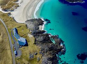
- 10 4. At the end of the beach keep close to the shore and follow a faint path around an obvious new house that has been built on the headland.
- 11 5. After passing the house bear left, picking up a tarmac road that leads you through the village. If you have time you might like to call in at Am Politician, Eriskay's only pub, where a bottle of whisky from the famous Whisky Galore ship wreck is stored behind the counter. You may also wish to stock up your supplies at the local shop (right at the junction).
- 12 6. Before turning left to cross the causeway separating Eriskay and South Uist, you might like to visit the church of St. Michael of the Sea. Inside the bow of an old lifeboat makes an attractive and unusual altar, a sign of the huge importance of the sea to the fishing communities of these islands.
- 13 7. After crossing the causeway make your way along the single track road past the tiny villages of Ludag and East Kilbride. The hills of Barra can be seen beyond the crystal blue waters of the Sound of Barra. There is a cafe at Kilbride and a great place to stop for a cuppa.
- 14 Turn left here and make your way towards the Polochar Inn - an excellent spot for some refreshments. Just before the inn there is a Neolithic standing stone by the shore
- 15 A prominent finger sign indicates the start of a beautiful stretch of walking along the west coast of South Uist. Turn right onto the path.10. Keep close to the beach until you join a small tarmac road. Continue to the end of this then carry on along a rough track and through a gate to pick up another fine path next to the shore.
- 16 This is beautiful and easy walking, with the ocean on your left and fertile machair fields on your right. Machair is a rare habitat made from peat and shell-rich sand; almost all the world's machair is found in the Hebrides and north west Scotland. It is famous for both its wildflowers and its abundant birdlife.
- 17 An attractive old burial ground here has a fine Celtic cross and some Commonwealth war graves.
- 18 The route uses a combination of grassy paths, sandy tracks and rough croft roads. Keep following the waymarkers and stay close to the coast and you won't go far wrong.14. Many of the crofters on the Uists breed cattle which thrive on the rich grazings of the machair. This area of South Uist is so low lying that large parts of the coastal plain are below sea level.
- 19 15. At this junction of two tracks turn right if you are staying the night in Kilphedar, but keep straight on if you are heading for Daliburgh.
- 20 16. On arriving at a small tarmac road turn right to head into Daliburgh, or left if you are continuing along the Hebridean Way. There is a supermarket and Post Office and lots of accommodation in Daliburgh and the surrounding area.


