To provide you with the best experience, cookies are used on this site.  Learn more

Allow cookies

Suaineabhal from Cairisiadar

Add Suaineabhal from Cairisiadar to your Itinerary

Summit of Suainabhal

About

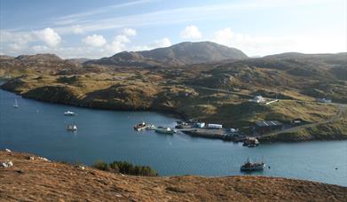
Suainebhal, “Sweyn’s fell”, is a great rounded elephant of a mountain that dominates Uig Bay. The ascent is straightforward and it provides an ideal summit for anyone who just wants to gain height quickly and enjoy the view. However it is very exposed and it can be decidedly cold, if not chilly, on the summit. So ensure you have wind proof clothing with you even on a warm day.

[This walk is described in detail and illustrated with Ordnance Survey map extracts in 'Walking on Harris and Lewis' by Richard Barrett, published by Cicerone Press 2010. Unless otherwise indicated, all images used here are copyright of the author.]

Map & Directions

Route Waypoints
  1. Turn off the main B8011 close to two small cottages to the north of Cairisiader (NB095333) and park considerately. Follow the narrow peat road for a few hundred metres until it forks. (NB088330) and then follow the left hand branch directly towards Suaineabhal.
  2. Head off southwest along the north bank of the Teurabrie River, then turn south to Tom Dhomhnull (NB083316) and then ascend directly to the summit of Suaineabhal (NB078309). keeping to the grass as much as possible. The 300m climb seems to go on for ever until finally the summit cairn comes into view on the right On a clear day there are glorious views across Uig Bay, out to the Flannan Isles and St Kilda and down to the mountains on the west side of Lewis and Harris with Loch Suaineabhal and Loch Gruineabhat prominent in the foreground. It’s definitely worth the effort. If you need shelter from the wind, there is a large boulder a few meters south of the summit cairn, large enough to provide a lunch stop for a half dozen or so.
  3. Retrace the route back to the start

Route Guides

Route Time -

4h - 5h

Distance -

5 miles

Grade -

Moderate to Difficult

Route Type -

Walk

What's Nearby

  1. Cliff Studio, located by Cliff Beach, Valtos, Uig, shows coastal landscape and abstract…

    1.88 miles away
  2. The breath-taking views over Loch Seaforth and the chance to see native trees in an…

    14.83 miles away

  3. 22.68 miles away
  1. 23.44 miles away
  2. The Braighe is the stretch of land (isthmus) linking Point and the villages of Branahuie…

    23.78 miles away
  3. 24.65 miles away
  4. Located just outside the gate to Eilean Glas Lighthouse, Scalpay Bothy offers shelter and…

    25.69 miles away
  5. This communal burial tomb would have been an important highly visible monument of the…

    26.38 miles away
  6. 26.6 miles away
  7. This east coast of Lewis self guided audio tour will take you as far north as the village…

    28.97 miles away
  8. A small cove accessed on the road to the Butt of Lewis lighthouse.

    33.35 miles away
  9. Download the Uist Unearthed app and discover two sites in one at Dùn an Sticir! Watch the…

    36.65 miles away
  10. Download the Uist Unearthed app and discover more about this mastery of Iron Age drystone…

    39.13 miles away
  11. 52.12 miles away
Previous Next

My Planner

You can build your own holiday itinerary here! Just browse our site and click this button to add to your itinerary when you see something you like. If your planner is not finished, simply click save and you can come back to it later on! You also have the option to send your itinerary to our tailor made holiday partner.

Places to Eat

Our Islands