About
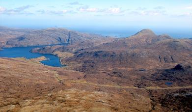
Most people ascend An Cliseam by a direct assault from the south east leaving their vehicle at one of the many good parking places along the A859. It’s a short, sharp climb; gaining some 650m in 3km and fine if you’ve only a couple of hours to spare. As you near the summit, there is an unpleasant boulder field to negotiate and I wouldn’t be surprised if ascending this direct route deters many visitors from ever considering hill walking in Harris ever again. There are better ways to climb An Cliseam. This route makes a day of it, steadily gaining height at a more leisurely pace and arriving at The Cliseam from the northwest along the ridge formed by Mullach an Langa, Mulla-Fo-Thuath and Mulla-Fo-Dheas. There are a number of sections that involve some easy scrambling and others that are best avoided by dropping off the rock to gain a lower path. Anyone who is confident moving on rock will enjoy the route, but it’s no place for novices, especially in poor visibility. But on a clear day, a traverse of the ridge with An Cliseam in front of you and the view of West Loch Tarbet, Taransay and Atlantic Ocean unfolding below you is one that will be remembered for a long time.
This walk is covered in detail including extracts of Ordnance Survey 1:50,000 maps in the Cicerone guidebook 'Walking on Harris and Lewis'.
Map & Directions
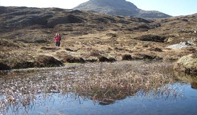
- Walk down the hill to the bridge and pick up the path that heads up Glen Scaladale along the north side of Abhainnn Scaladall. Don’t be too concerned that the path is unmarked on the OS Landranger series and is shown as petering out on the OS Explorer series. It exists and although it can be muddy after heavy rain, it is easy to follow all the way up to Loch Mhisteam.
- At this point it does disappear and you are left to pick your way to the east ridge of Mullach an Langa (NB143094).
- The ascent starts easy enough but you soon encounter steeper grass and boulders near the summit. This is certainly the hardest section of the entire horseshoe, but as you work your way towards the top, the views to the north and east will make it all worthwhile.
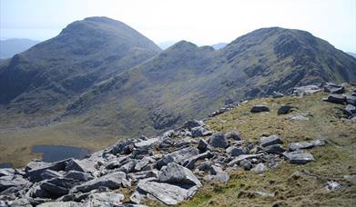
- Continue south along the ridge, passing over some boulders to gain the summit of Mulla-Fo-Thuath (NB140084). Descend southwards to the col passing over a distinctive band of quartz then follow the ridge as it turns southeast to the summit of Mulla-Fo-Dheas, (NB143077).
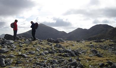
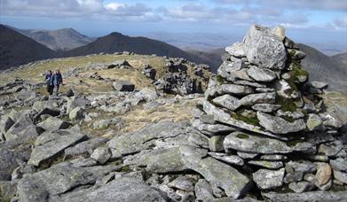
- An exposed path leaves the northern side of the summit and heads east towards An Cliseam or you can navigate the crags along the eastern ridge and descend to the bealach above An t-Isean. From here it is a short ascent to the summit of An Cliseam (NB 155073) the last few hundred meters involving a scramble through jagged boulders.
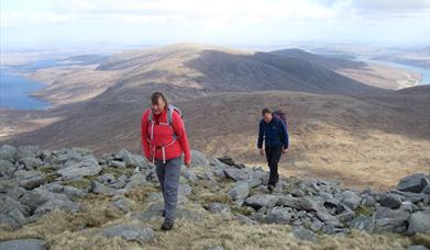
- When you are ready to leave, descend to the south east until you are safely through the band of crags which probably give An Cliseam its name which translates as “Rocky Cliff”. Once you get onto easier ground, maintain your height and traverse around the head of Allt Tomnabhal (NB160077). Skirt below the prominent rock slabs on the south eastern slopes of Tomnabhal (NB165078) keeping to the easier ground before swinging around to the north east to make for the two small lochans (NB 184083) that lay directly to the west of Cleit Ard.
- There is a bench here where you can rest your weary bones. From here it’s 1.5km northwards along the track back to the main road.